

Cipeagal Bheag [Cipeagil Bheag] [Ciopeagal Bheag]
Good walks are even better shared.
Overview
Cipeagal Bheag
Cipeagal Bheag, sitting proudly at 586 meters, may not be the tallest mountain in the Highlands, but it certainly packs a punch.
Geology
This little gem is primarily composed of schist and gneiss. These ancient rocks have been shaped by millions of years of geological activity, forming the rugged beauty that we see today. Clambering over these stones, you can almost hear the whispers of time!
Routes
The most popular starting point for summiting Cipeagal Bheag is at Cuil Lodge. The 5.5 km route is moderate in difficulty and generally takes around 2.5 hours to complete—perfect for a half-day adventure! Don’t forget to enjoy the meandering trails and stunning views along the way.
Summit Features
Reaching the summit, you’re greeted by a modest cairn resting atop a rocky outcrop. It’s a fantastic spot to catch your breath—in both a literal and metaphorical sense! From here, the views are breathtaking, looking out over Loch Awe and sweeping vistas of the Southern Highlands.
Terrain Type
The terrain is a delightful mix of rocky and grassy, with some areas potentially boggy. A word to the wise: you might want to invest in a sturdy pair of hiking boots before tackling this terrain!
Views
The best views are typically during late spring and early autumn, when the weather is more stable and the landscape bursts to life with colour. On clear days, don’t forget to bring your binoculars to take in the distant peaks of other nearby hills.
Hazards
As always in the Highlands, be cautious of loose rocks, especially on the descent. Weather conditions can change rapidly, so always prepare for the unexpected. Remember, it’s not a proper Highland experience unless your waterproof jacket gets a workout!
Nearby Summits
Nearby, you'll find the impressive Beinn a' Chochuill and Beinn Eunaich, both waiting to be explored by those seeking more miles in their legs.
Access
To access Cipeagal Bheag, park at Cuil Lodge, where a limited amount of space awaits you. If you're relying on public transport, be prepared for a bit of a trek from Dalavich. For a full experience, you’ll want to stop in Oban first to stock up on snacks and perhaps enjoy a cheeky pint!
Facilities
Don’t expect much in terms of facilities on the mountain; it’s all about the great outdoors here! Make sure to hit up Oban for cafes and toilets before setting off on your journey.
History
The meaning of Cipeagal Bheag literally translates to 'little Ciopeagal' in Gaelic, reminding us of its friendly stature among the giants of the Highlands. This mountain, like many in the area, has witnessed it all and remains a beloved destination for adventurers big and small.
Get out there and make your own history on Cipeagal Bheag! It may be small, but it has a mighty spirit.
Explore routes near Cipeagal Bheag [Cipeagil Bheag] [Ciopeagal Bheag]
Public walks starting within 80 km of this hill. Nearby does not mean a route reaches the summit; check its map and access before setting out.
Beautiful private beach walk Isle of Harris
View route
Berneray Community Hall to the beautiful beach
View route
Fairy Lochs Liberator Wreckage Circuit
View route
Route planning notes
These notes describe possible approaches, not verified navigable routes or permission to cross land. Check current paths, local access rules and conditions before setting out.
Cuil Lodge Route
A moderate route that begins at Cuil Lodge, offering gradual elevation gain and some stunning views of the surrounding terrain.
Make a day of it, together
Find someone to share the walk with, or organise a day out along a route you like.
Photo Gallery
View all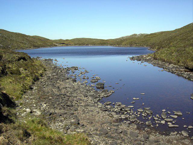 Photo could not load
NB2406 : Ciopeagal Bheag Lochan
Colin Kinnear
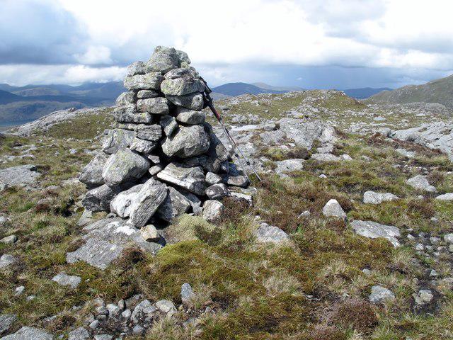 Photo could not load
NB2406 : Cipeagil Bheag [Ciopeagal Bheag] [Cipeagal Bheag]
Rude Health
Hill facts and local notes
Classifications
Elevation
336m
1,102 ft
Prominence
171m
Coordinates
57.9621, -6.6554
NB247064
OS Map
13 14
Explorer: 456 457
At the Summit
At the summit, you will find a small rocky outcrop and a cairn that adds to the charm. The views from the top are enough to take your breath away—just make sure you remember to breathe!
Terrain & Geology
Cipeagal Bheag is primarily composed of schist and gneiss, common in the region. The rocks are ancient, having undergone significant metamorphic processes over millions of years, resulting in a rugged and beautiful landscape that is a feast for the senses.
Views & Scenery
From the summit, you can enjoy views of Loch Awe, the surrounding hills, and on a clear day, the peaks of the Southern Highlands are visible.
History & Heritage
Name Origin
The name Cipeagal Bheag is believed to translate to 'little Ciopeagal', with 'Bheag' being a diminutive form in Gaelic, possibly referencing its size compared to nearby peaks.
Historical Significance
The mountain is part of an ancient landscape that has seen the footfalls of many generations, from prehistoric man to modern hikers seeking the beauty of the Highlands.
Getting There & Facilities
Check current local access restrictions, parking rules and transport timetables before travelling. These notes do not confirm public access to the summit.
Parking
Cuil Lodge has a small parking area suitable for a handful of vehicles. Arrive early to secure your spot, as it is popular among local walkers.
Public Transport
The nearest public transport is via bus services to the village of Dalavich, about a 10km hike away, and from there, it's a trek to Cipeagal Bheag.
Nearby Facilities
There are no facilities on the mountain itself. The nearest toilets and cafes are located in Oban, making it wise to stop before your adventure.
Safety Information
Known Hazards
- Loose rocks in some areas, potential for boggy conditions, and unpredictable weather changes common in the Highlands.
General Safety Tips
- Check weather conditions before setting out
- Carry appropriate clothing and equipment
- Let someone know your planned route
- Take a map, compass, and GPS device
- Carry emergency supplies: food, water, first aid kit, torch
Hills
Some common questions about the hills answered
Are there group walks up Cipeagal Bheag [Cipeagil Bheag] [Ciopeagal Bheag]?
Many walkers use Walkmates to join or organise walks with others. You can check for group walks around Cipeagal Bheag [Cipeagil Bheag] [Ciopeagal Bheag] through the maps
Are there other walkers around Cipeagal Bheag [Cipeagil Bheag] [Ciopeagal Bheag]?
Activity varies by location and time, but Walkmates lets you see whether others have shared walks or shown interest in this area. Find other people through the walking friends search walking friends for Cipeagal Bheag [Cipeagil Bheag] [Ciopeagal Bheag] search or of course create your own walk for Cipeagal Bheag [Cipeagil Bheag] [Ciopeagal Bheag]
Can I organise a walk to Cipeagal Bheag [Cipeagil Bheag] [Ciopeagal Bheag]?
Yes. If there aren’t any walks listed already, you can create a walk and make it available for others to join.
If you're signed up to Walkmates, you can create a walk to Cipeagal Bheag [Cipeagil Bheag] [Ciopeagal Bheag].
How do I find a walk up this hill?
There are often multiple ways to walk this hill, depending on experience and route preference. Walkmates helps you explore walks and routes that others have shared.
Can I suggest a new route up Cipeagal Bheag [Cipeagil Bheag] [Ciopeagal Bheag]?
Yes. You can suggest or create routes to share with others. Walkmates focuses on the social side of walking, so routes are used to help people organise walks and explore areas together, rather than as detailed navigation tools or route libraries.
Other uses really appreciate knowledgeable walkers sharing their routes. Share your favourite route to Cipeagal Bheag [Cipeagil Bheag] [Ciopeagal Bheag] here
The is an error or something incorrect about this hill. How do I let you know?
We always strive to keep the information on Walkmates as accurate as possible. If you find an error, please let us know through the contact form and we'll aim to correct it as quickly as possible
Community Discussion
Comments
Location
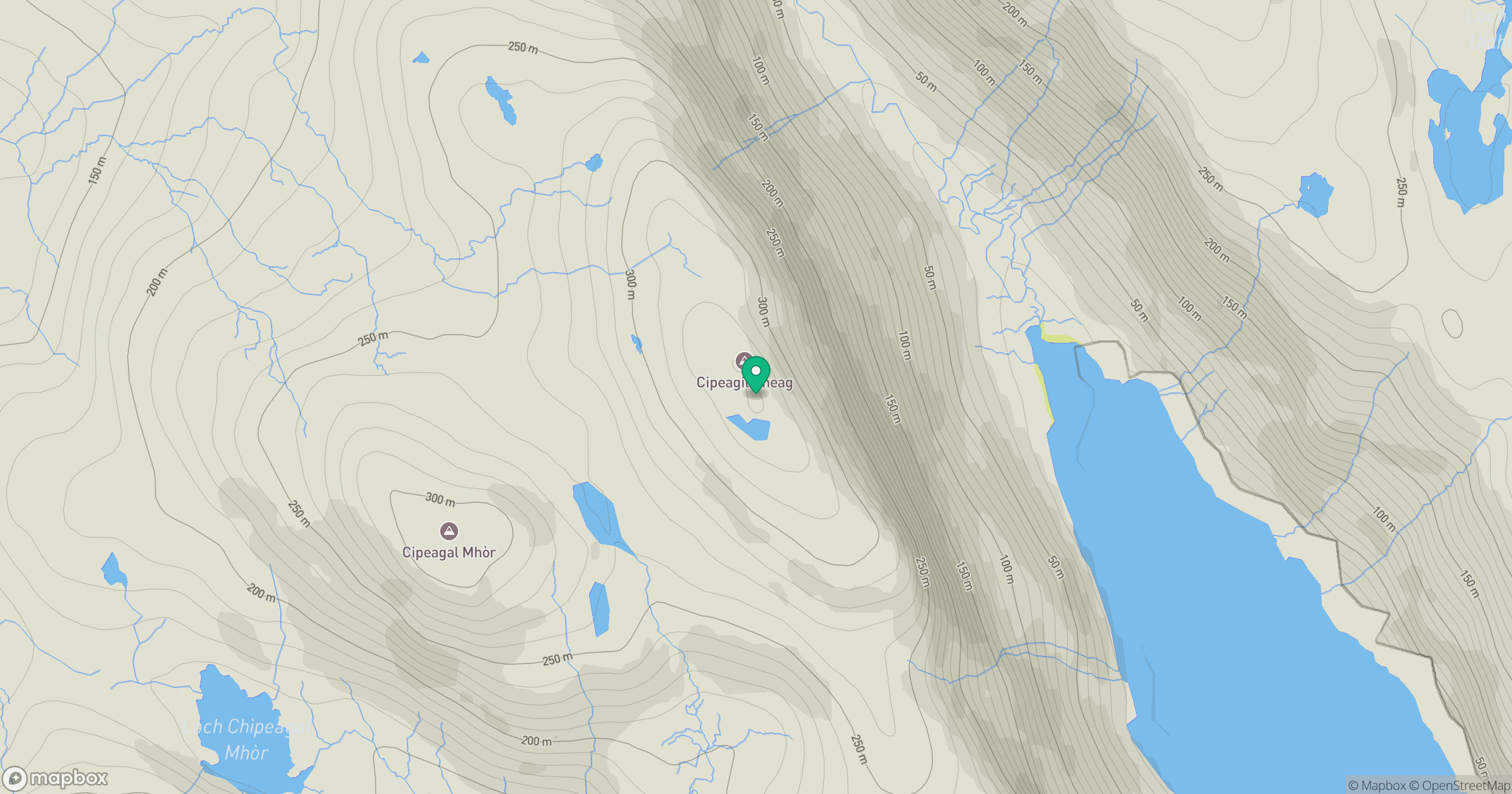
Grid reference: NB247064
View on OpenStreetMapOpens a map in a new tab, centred on the hill.
Hills within 30 km
Straight-line distance, not a walking route or confirmation of access.
No comments yet. Be the first.